Every open-world game has a map. Very few open-world games have a world. The difference is what Rockstar has spent 25 years perfecting — and it's why people still explore Los Santos a decade after GTA V's launch, while the maps of most competitors are forgotten within months.
GTA maps aren't just big. They're designed with a level of intentionality that borders on obsessive. Every intersection, every billboard, every shift in architecture from one neighborhood to the next — it all serves a purpose. This guide breaks down the principles, techniques, and evolution behind the most iconic maps in gaming history.
The Core Philosophy: "Every Street Tells a Story"
Rockstar's approach to map design comes down to one idea: the map is a character, not a container. It doesn't just hold missions — it communicates wealth, poverty, culture, danger, and opportunity through its physical structure. A player should be able to stand at any point on the map and know something about where they are just by looking around.
Narrative Geography
Neighborhoods tell stories through architecture, signage, parked vehicles, and NPC behavior. The transition from Vinewood Hills to Strawberry in GTA V isn't just visual — it changes the entire mood, the ambient sounds, the police response time, and even the types of random events that spawn.
Intuitive Wayfinding
Rockstar designs maps so you can navigate by landmarks, not by minimap. Major roads follow logical patterns, landmark buildings are visible from multiple districts, and elevation changes create natural viewpoints. This is why GTA players eventually turn off the GPS — the world itself guides you.
Contrast & Juxtaposition
The map is designed around contrasts. Rich next to poor, urban next to rural, beautiful next to ugly. These transitions create tension, comedy, and social commentary. The Vinewood sign overlooking a gang-controlled neighborhood? Not accidental.
Rhythm & Pacing
A good GTA map has rhythm: dense city gives way to suburbs, which give way to open countryside, which builds back to a new kind of density. This pacing prevents fatigue and ensures that driving across the map feels like a journey, not a commute.
The Evolution: GTA III to GTA 6
Each GTA generation didn't just make the map bigger — it made it deeper. Here's how the design philosophy evolved across the entire series:
GTA III — Liberty City
The map that started it all. Three islands unlocked progressively — Portland, Staunton, Shoreside Vale — teaching players about the world through controlled expansion. The genius was the bridge system: each new island felt earned, and the geography created natural barriers that made narrative sense. No interiors, minimal variety in buildings, but the foundation of "neighborhood identity" was already here — the industrial docks of Portland felt nothing like the suburban hills of Shoreside.
GTA San Andreas — State of San Andreas
The leap that changed everything. Three full cities (Los Santos, San Fierro, Las Venturas) connected by countryside, desert, and mountains. San Andreas proved that empty space isn't wasted space — the rural areas between cities gave the map breathing room and made each city's arrival feel momentous. The countryside was rich with hidden content: ghost towns, military bases, forests where players got lost for hours. This was also the first GTA where terrain variety mattered — desert driving felt different from city driving felt different from mountain driving.
GTA IV — Liberty City (Reimagined)
Rockstar made the map smaller than San Andreas — and it was the right call. GTA IV proved that density beats area. Liberty City was smaller but dramatically more detailed: individual street corners had unique character, the subway system created a secondary navigation layer, and the boroughs felt like real neighborhoods with real cultures. Broker/Dukes (Brooklyn/Queens) had row houses and industrial decay. Algonquin (Manhattan) had glass towers and yellow cabs. Every borough was a distinct world.
GTA V — Los Santos & Blaine County
The masterclass. GTA V combined San Andreas's scale with GTA IV's density. Los Santos alone was more detailed than all of GTA IV's Liberty City, and Blaine County added wilderness, desert, small towns, and a coastline that felt genuinely remote. The map was designed around its three protagonists: Michael's Rockford Hills mansion, Franklin's Strawberry apartment, and Trevor's Sandy Shores trailer each anchored a different region. The highways connected everything with cinematic driving routes that framed the skyline perfectly. Ten years later, players are still finding hidden details.
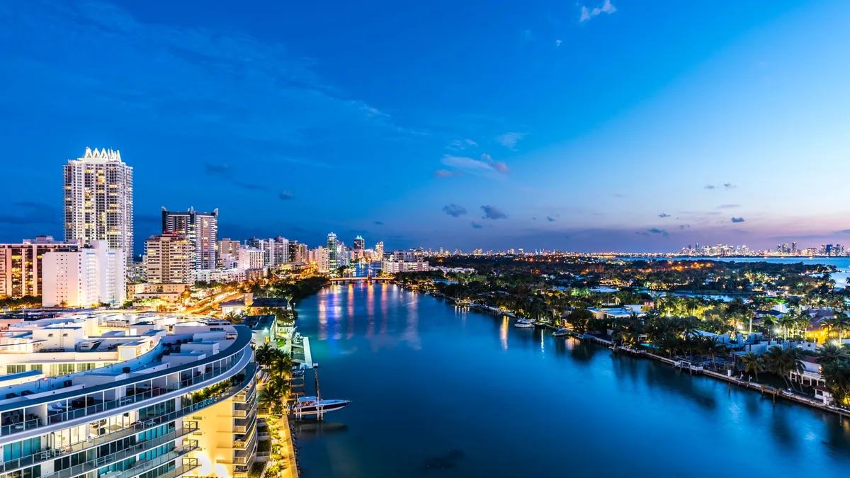
GTA 6 — Leonida (Vice City & Beyond)
What we know from trailers and leaks suggests Leonida will include a reimagined Vice City (Miami) plus surrounding areas — swamps, Keys-like islands, suburban sprawl, and possibly rural Florida. The design challenge is new for Rockstar: Florida's geography is flat. Unlike Los Santos with its hills and mountains creating natural viewpoints, Leonida will need to create visual interest and navigation landmarks in a largely sea-level landscape. The solution seems to involve water — rivers, canals, coastline, and bridges — as the primary structural element. Check our full map analysis for the latest breakdown.
Key Design Techniques Rockstar Uses
Behind the artistry, there are concrete techniques that make Rockstar's maps work. These have been documented through developer talks, modder analysis, and community deep dives:
1 The "Sightline" system
Rockstar designs major intersections and roads so a landmark is always visible on the horizon. In Los Santos, the Maze Bank Tower is visible from dozens of locations. This serves two purposes: it gives players a constant orientation point (you always know roughly where "downtown" is), and it creates a sense of scale by showing you how far away the landmark still is. In GTA 6, the Vice City skyline will likely serve this role from the swamplands and suburban areas.
2 Progressive density gradients
GTA maps never transition abruptly from city to wilderness. Instead, they use gradients: downtown → commercial strip → residential suburbs → light industrial → farmland/wilderness. Each zone blends into the next through transitional blocks that share characteristics of both. This is why driving from Los Santos to Blaine County feels natural, not jarring — the houses spread out, sidewalks disappear, roads get rougher.
3 "Weenies" (landmark magnets)
Borrowed from theme park design (Walt Disney coined the term), a "weenie" is a visual magnet that draws you forward. In GTA, these are distant mountains, radio towers on hills, bridges spanning bays, or a Ferris wheel on a pier. They pull the player forward organically — you see something interesting and you want to go there. Every region in a GTA map has at least one weenie visible from its entry points.
4 The "Playable Postcard" approach
Rockstar builds maps based on real cities but doesn't recreate them 1:1. They distill the essence — the postcard version. Los Santos captures what Los Angeles feels like, not what it looks like block-by-block. The Hollywood sign, the Venice Beach boardwalk, the freeway system, the wealth divide — all present, but compressed and rearranged to create a better game world. This is why GTA maps feel more "real" than many games based on actual geography: Rockstar captures the vibe, not the GPS data.
5 Acoustic & atmospheric zoning
Sound design is part of map design. Each district has its own ambient soundscape — traffic density, music leaking from buildings, bird species, wind patterns, NPC conversations in different languages. GTA V's Sandy Shores has desert wind and distant highway noise. Downtown Los Santos has sirens, construction, and helicopter rotors. These audio cues tell players where they are even without looking at the screen. GTA 6's rumored expanded soundtrack system suggests this will be even more sophisticated.
6 Mission-informed geography
Rockstar doesn't design the map and then figure out where to put missions. The map and missions are co-developed. A heist needs a long approach road for a getaway sequence, so the map gets a highway there. A chase mission needs a shortcut through alleys, so the block layout accommodates it. A sniper mission needs a vantage point, so the elevation creates one. The map serves the gameplay — always.
What This Means for GTA 6's Leonida
Applying everything we know about Rockstar's design philosophy to what we've seen of Leonida:
🌴 Water as the structural backbone
Florida is defined by water. The Everglades, the Keys, the Intracoastal Waterway, the Atlantic coast — water is everywhere. GTA 6's map will likely use waterways the way GTA V used highways: as connective tissue between regions. Expect boats and watercraft to be more important than any previous GTA, with canals, rivers, and coastal routes as secondary road systems.
🏖️ Horizontal variety instead of vertical
Without mountains, Rockstar will create variety through biomes: neon-lit urban beach, mangrove swamp, strip-mall suburban sprawl, sugar-cane farmland, tropical keys. The challenge is making flat terrain feel diverse. Look for architectural changes, vegetation shifts, road quality differences, and lighting variations to do the heavy lifting that elevation does in other GTA maps.
🌆 Vice City as the "Maze Bank Tower"
The Vice City skyline — lit up in neon at night — will almost certainly serve as the primary sightline landmark. From the swamps, suburbs, and beaches: you should be able to look toward the city and see it glowing on the horizon. This creates the magnetic pull that drives exploration toward the urban center.
🐊 The "Danger Gradient"
Every GTA map has areas where the world itself is hostile. In GTA V: mountain lions, train tracks, steep cliffs. In Leonida, expect the Everglades to fill this role — gators, murky water, getting lost in mangrove mazes. This creates a natural "risk/reward" layer where hidden content exists in the most dangerous terrain.
Why This Matters to Players
1 You find more secrets
Once you understand that Rockstar hides content in transitional zones, dead-end alleys, and seemingly empty areas, you start checking those places. The easter eggs in GTA V were overwhelmingly placed in spots most players drive past — rooftops, underwater, behind buildings, in spaces between neighborhoods.
2 You appreciate the craftsmanship
Every storefront sign, every cracked sidewalk, every carefully placed palm tree was put there by a designer who thought about what it communicates. Reading the map as a designed experience rather than a backdrop makes GTA an even richer game — the difference between watching a movie for the plot and watching it for the cinematography.
3 You navigate better
Players who understand sightlines and landmark design can navigate without the minimap. This isn't just an immersion boost — it makes you faster in multiplayer, better at getaways, and more aware during missions. The best GTA Online players know the map so well they never need GPS.
Frequently Asked Questions
How big is the GTA 6 map?
Based on trailer analysis and leaks, the GTA 6 map (Leonida/Vice City) appears significantly larger than GTA V's Los Santos, potentially 2–4x the playable area.
Will GTA 6 have multiple cities?
The confirmed setting is Leonida (based on Florida) with Vice City as the main metro. Trailer footage shows extensive rural, suburban, and swamp areas surrounding the city.
Is the GTA 6 map bigger than RDR2?
Likely comparable or larger. RDR2's map was enormous but much of it was wilderness. GTA 6's map should be denser with more urban detail and activities per square mile.